| URL | http://<catalog-url>/<serviceName>/MapServer |
|---|---|
| Supported Operations | Export Map Identify Find Generate KML |
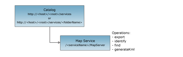
| Parent Resource | Catalog |
| Child Resources | Map Tile Layer / Table Legend All Layers / Tables KML Image Map Service Extension |
Description
Map services offer access to map and layer content. Map services can either be cached or dynamic. A map service that fulfills requests with pre-created tiles from a cache instead of dynamically rendering part of the map is called a cached map service. A dynamic map service requires the server to render the map each time a request comes in. Map services using a tile cache can significantly improve performance while delivering maps, while dynamic map services offer more flexibility. Map services should always be published as pooled services.
From 10 onward, in addition to layers, map services could also publish standalone tables.
The response includes a new tables property that contains some basic information about tables.
The child layer resource is now a Layer / Table resource in that it represents
either a layer or a table depending on the ID that was specified.
Support for time-aware map services was added at 10.
If the map supports quering and exporting maps based on time,
the response will include a timeInfo property which includes information such as
the map's time extent and the map's native time reference.
However, note that the REST API always encodes time in UTC (milliseconds from epoch).
At 10.0 SP1, support for a Map Service Legend child resource was added.
At 10.0 SP1, mapservice resource includes scale information (minScale and maxScale) for layers.
The REST API map service resource represents a map service. This resource works only with the default data frame of your published map document. This resource provides basic information about the map, including the layers that it contains, whether the map is cached or not, its spatial reference, initial and full extents, map units, and copyright text. It also provides some metadata associated with the service such as its service description, its author, and keywords. If the map is cached, then additional information about its tiling scheme such as the origin of the cached tiles, the levels of detail, and tile size is included. Note that multi-layer caches are only accessible in REST via export, and these requests are treated as a dynamic map service. Tile access is not supported in REST for multi-layer caches.
The map service resource supports several operations:
- Export map - Used to export a map image from a dynamic map service. The resulting map can be used for display and be in a different projection from the original data source. When generating a map image, map services are not able to change feature rendering for an existing layer, add a dynamic layer, or change the layer draw order.
- Identify - Returns information about features in one or more layers based on where a user clicks on the map.
- Find - Returns information about features in one or more fields in one or more layers based on a key word.
- Generate KML - Generates a KML document wrapped in a kmz file. The document contains a network link to the KML service endpoint with specified properties and parameters. This operation is valid on services that have not been restricted by using a token service.
- Query on a Layer / Table - Returns a subset of features in a layer or records in a table based on query criteria.
Map services do not expose editing capabilities. They provide read-only access to feature and attribute content.
Resource Hierarchy
Parameters
| Parameter | Details |
|---|---|
| f | Description: The
response format. The default response format is html. Values: html | json | kmz | lyr | nmf | jsapi | ve | gmaps |
Example Usage
Example 1: URL for the "ESRI_StateCityHighway_USA" map service on sampleserver1.
http://sampleserver1.arcgisonline.com/ArcGIS/rest/services/Specialty/ESRI_StateCityHighway_USA/MapServerJSON Response Syntax
Note: The supportedImageFormatTypes property was added to the JSON response at 9.3.1
{
"currentVersion": <currentVersion>, //Added at 10.0 SP1
"serviceDescription" : "<serviceDescription>",
"mapName" : "<mapName>"
"description": "<description>",
"copyrightText" : "<copyrightText>",
"layers": [ //the spatial layers published by this service
    {
    "id" : <layerId1>,
    "name" : "<layerName1>",
    "defaultVisibility" : <true|false>,
    "parentLayerId" : <parentLayerId1>,
    "subLayerIds" : [<subLayerId11>, <subLayerId12>]
    "minScale": <minScale1>, //Added at 10.0 SP1
    "maxScale": <maxScale1>
    },
    {
    "id" : <layerId2>,
    "name" : "<layerName2>",
    "defaultVisibility" : <true|false>,
    "parentLayerId" : <parentLayerId2>,
    "subLayerIds" : [<subLayerId21>, <subLayerId22>]
    "minScale": <minScale1>,
    "maxScale": <maxScale1>
    }
],
"tables": [ //the tables published by this service - from 10 onward
    {
    "id" : <tableId1>,
    "name" : "<tableName1>"
    },
    {
    "id" : <tableId2>,
    "name" : "<tableName2>"
    }
],
"spatialReference" : {<spatialReference>},
"singleFusedMapCache" : <true | false>,
"tileInfo": {
    "rows" : <rows>, "cols" : <cols>, "dpi" : <dpi>, "format" : <format>, "compressionQuality" : <quality>,
    "origin" : {<point>},
    "spatialReference" : {<spatialReference>},
    "lods": [
        {"level" : <level1>, "resolution" : <resolution1>, "scale" : <scale1> },
        {"level" : <level2>, "resolution" : <resolution2>, "scale" : <scale2> }
    ]
},
"initialExtent" : {<envelope>},
"fullExtent" : {<envelope>},
//from 10 onward - if the map supports querying and exporting maps based on time
"timeInfo" : {
  "timeExtent" : [<startTime>, <endTime>],
  "timeReference" : {
    "timeZone" : "<timeZone>",
    "respectsDaylightSaving" : <true | false>
  }
},
"units" : "<units>",
"supportedImageFormatTypes" : "<supportedImageFormatTypes>",
"documentInfo": {
    "<key1>" : "<value1>",
    "<key2>" : "<value2>"
},
//comma separated list of supported capabilities - e.g. "Map,Query,Data"
"capabilities" : "<capabilities>"
}
JSON Response Example
{
"currentVersion": 10.01,
"serviceDescription" : "Test Map Service Description",
"mapName" : "Street Map Pro Data",
"description": "Street Map USA",
"copyrightText" : "ESRI",
"layers": [
    {"id" : 0, "name" : "Cities", "defaultVisibility" : true, "parentLayerId" : -1, "subLayerIds" : null, "minScale": 0, "maxScale": 0},
    {"id" : 1, "name" : "States", "defaultVisibility" : true, "parentLayerId" : -1, "subLayerIds" : null, "minScale": 0, "maxScale": 0},
    {"id" : 2, "name" : "Counties", "defaultVisibility" : false, "parentLayerId" : -1, "subLayerIds" : [3, 4], "minScale": 0, "maxScale": 0},
    {"id" : 3, "name" : "Large Counties", "defaultVisibility" : false, "parentLayerId" : 2, "subLayerIds" : null, "minScale": 0, "maxScale": 0},
    {"id" : 4, "name" : "Small Counties", "defaultVisibility" : false, "parentLayerId" : 2, "subLayerIds" : null, "minScale": 0, "maxScale": 0}
],
"spatialReference" : {"wkid" : 4326},
"singleFusedMapCache" : true,
"tileInfo": {
    "rows" : 512, "cols" : 512, "dpi" : 96, "format" : "JPEG", "compressionQuality" : 75,
    "origin" : {"x" : -130.0, "y" : 50.0},
    "spatialReference" : {"wkid" : 4326},
    "lods": [
        {"level" : 0, "resolution" : 8.46, "scale" : 32000.0 },
        {"level" : 1, "resolution" : 4.23, "scale" : 16000.0 },
        {"level" : 2, "resolution" : 2.11, "scale" : 8000.0 },
        {"level" : 3, "resolution" : 1.05, "scale" : 4000.0 },
        {"level" : 4, "resolution" : 0.52, "scale" : 2000.0 }
    ]
},
"initialExtent" : {
    "xmin" : -109.55, "ymin" : 25.76, "xmax" : -86.39, "ymax" : 49.94,
    "spatialReference" : {"wkid" : 4326}
},
"fullExtent" : {
    "xmin" : -130.0, "ymin" : 24.0, "xmax" : -65.0, "ymax" : 50.0,
    "spatialReference" : {"wkid" : 4326}
},
"units" : "esriDecimalDegrees",
"supportedImageFormatTypes": "PNG32,PNG24,PNG,JPG,DIB,TIFF,EMF,PS,PDF,GIF,SVG,SVGZ",
"documentInfo": {
    "Title" : "StreetMap USA.mxd",
    "Author" : "ESRI Data Team",
    "Comments" : "ESRI Data and Maps 2004",
    "Subject" : "Street level data for the US",
    "Category" : "vector",
    "Keywords" : "StreetMap USA"
},
"capabilities" : "Map,Query,Data"
}