| URL | http://<catalog-url>/<serviceName>/ImageServer |
|---|---|
| Supported Operations | Export Image Query Download |
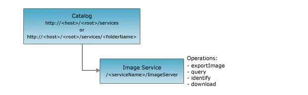
| Parent Resource | Catalog |
| Child Resources | KML Image Raster Catalog Item Raster File |
Description
An image service provides access to published imagery. An image service supports two views of the published imagery: a mosaicked image view and a raster catalog view.
Use an image service to do the following:
- Get image service information, including its native spatial reference, extent, pixel size, pixel type, number of bands, and band statistics
- Generate an image
- Query the raster catalog (added at 10)
- Download rasters (added at 10)
The REST API image service resource represents an image service published with ArcGIS Server. The resource provides basic information associated with the image service such as the service description, its name, description, extent, pixel sizes, and band counts.
From 10 onward, this resource also returns the accessible fields of the image service.
The image service resource supports the following operations:
- Export Image: Returns a seamless mosaicked image for the specified area.
- Identify (added at 10): Identifies the content of an image service.
- Query (added at 10): Query the image service.
- Download (added at 10): Downloads raw raster files.
Also added at 10 are the following child resources:
- Raster Catalog Item: Represents a single raster catalog item.
- Raster File: Streams the content of a single raw raster file.
Note that the Query and Download operations and the Raster Catalog Item and the Raster File resources are NOT available if the service does not include an accessible image catalog.
Resource Hierarchy
Parameters
| Parameter | Details |
|---|---|
| f | Description: The
response format. The default response format is html. Values: html | json | kmz |
Example Usage
Example 1: URL to an Image Service named "MyImage".
http://myserver/arcgis/rest/services/MyImage/ImageServer
JSON Response Syntax
{
"currentVersion": <currentVersion>, //Added at 10.0 SP1
"serviceDescription" : "<serviceDescription>",
"name" : "<name>",
"description" : "<description>",
"extent" : {<extent>},
//from 10 onward - if the Image Service supports query/exportImage based on time
"timeInfo" :
{
  "timeExtent" : [<startTime>, <endTime>],
  "timeReference" : null
 },
"pixelSizeX" : <pixelSizeX>,
"pixelSizeY" : <pixelSizeY>,
"bandCount" : <bandCount>,
"pixelType" : "<pixelType>",
"minPixelSize" : <minPixelSize>,
"maxPixelSize" : <maxPixelSize>,
"copyrightText" : "<copyrightText>",
"serviceDataType" : "<serviceDataType>",
"minValues" : [<minValue1>, <minValue2>],
"maxValues" : [<maxValue1>, <maxValue2>],
"meanValues" : [<meanValue1>, <meanValue2>],
"stdvValues" : [<stdvValue1>, <stdvValue2>],

//accessible fields - added at 10
"objectIdField" : "<objectIdFieldName>",
//Query and Download operations and Raster Catalog Item and Raster File resources
//are available only if fields is not null and not empty
"fields" : [
  {"name" : "<fieldName1>", "type" : "<fieldType1>", "alias" : "<fieldAlias1>"},
  {"name" : "<fieldName2>", "type" : "<fieldType2>", "alias" : "<fieldAlias2>"}
]
}
JSON Response Example
{
"currentVersion": 10.01,
"serviceDescription" : "Test Image Service Description",
"name" : "wsiearth.tif",
"description" : "wsiearth.tif",
"extent" : {"xmin" : -180, "ymin" : -90, "xmax" : 180, "ymax" : 90, "spatialReference" : {"wkid" : 4326}},
"timeInfo" : {"timeExtent" : [1106822673000,1125907321000], "timeReference" : null},
"pixelSizeX" : 30.386,
"pixelSizeY" : 30.386,
"bandCount" : 3,
"pixelType" : "U8",
"minPixelSize" : 0.0,
"maxPixelSize" : 0.0,
"copyrightText" : "ESRI",
"serviceDataType" : "esriImageServiceDataTypeRGB",
"minValues" : [0.0, 0.0, 0.0],
"maxValues" : [255.0, 254.0, 255.0],
"meanValues" : [82.707, 107.448, 60.118],
"stdvValues" : [39.838, 37.735, 36.466]
,"objectIdField":"OBJECTID",
"fields":[{"name":"OBJECTID","type":"esriFieldTypeOID","alias":"OBJECTID"},{"name":"Shape","type":"esriFieldTypeGeometry","alias":"Shape"},{"name":"Name","type":"esriFieldTypeString","alias":"Name"}]
}